Friday, February 10, 2012

Hike No. 6 - A Walk with Tanner

February 6, 2012
1.2 Miles

OK, calling a 1.2 mile dog walk a hike may be stretching it, but we both enjoyed the outing, and returned relaxed and refreshed. That's what it's all about.

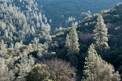
It was a gray day, portending the rain that came a few hours later. I had a goal in mind, which was to bring home an image I could play with in my new software toy, Nik Color Efex 4. This software consists of a long list of filters, which can make strong changes to images. You can use them to enhance an image within whatever you consider "traditional" photography, or you can go all out, and create images only seen in your mind's eye.

As you can see, with this one I went all out. What I like about the program is that it loosens up my vision, getting me out of the Ansel Adams and David Muench modes that I hold so dear.

What the camera saw ...

... and what the mind's eye saw - with a little help from Nik.

Hike no. 5 - Codfish Falls


February 3, 2012
3.2 Miles


I accessed the trailhead, located where the Ponderosa Way Bridge crosses the North Fork of the American River, by dropping down Ponderosa way from the Foresthill Road between Auburn and Foresthill. You can also zig-zag down Ponderosa way from I-80 near Colfax. Either way you are dealing with switchbacks, dirt roads that are rough in places, and some fine views of the canyon of the North Fork. You would probably make it fine in your Miata, but feel most secure in a high-centered, AWD vehicle.

The frosty Ponderosa way bridge over the North Fork off the American River
I crept carefully in our venerable Explorer across the frost-covered wooden planks of the bridge, still in the shade of the deep canyon at 10 AM. The rusty cable railings didn't look like they would help much if we began slipping sideways. The river ran clear and cold below, carving into bedrock strata of seafloor sediments tilted to nearly 90 degrees. A light jacket over my fleece vest felt good as I started down the trail, but as it emerged into sunlight I stopped to stuff it in my daypack. Also in the pack was my Sigma 10-28mm wideangle lens, and around my neck on a comfortable strap was my old Nikon D80, extracted from retirement today to see if its lighter weight compared to the D300 would make it a good hiking camera. Attached to it was my not-quite-do-everything Nikkor 18-200mm VR, with which I have a conflicted relationship. Conflicted, because the designers were unable to figure out how to keep the zoom from slipping to full extension as the camera dangles from the strap. Or when angled downward to frame a photo. A bit of duct tape goes into the pack next trip. In my hand I carried a tiny Velbon tripod. I lust for a carbon fiber, but but have not yet gathered the gumption to spend the required $600.*

The trail to Codfish Falls
Any lustful or negative thoughts regarding photo gear were totally buried by the delight of the trail, which makes its level way downstream on the sunny side of the canyon, always within sight and sound of the river. Casual slip-and-slide side trails make their way down to the river, where sandy beaches and swimming holes would be attractive in the summer.

The morning light spilling down the opposite slope of the canyon outlined the tall Grey Pines in delightful backlighting. Until recently these trees had been know commonly as "Digger Pines", a name applied with reference to the Nissenan, or Southern Maidu, by the gold miners of the 1800's, based on their observation that they commonly dug up roots for food and other uses. The miners also left behind piles of cobbles on a bar along the opposite bank, washed clean by hydraulic mining. The resulting sediment carried down the American, and other rivers, into the Central Valley built up there, causing flooding and damaging agricultural land. A temporary solution on the NF was to build the Clementine Dam downstream a few miles, solely for the purpose of trapping the sediment before it could be carried further downstream. Shortly thereafter the release of sediment was outlawed by the nation's first environmental legislation.

Grey pines backlit by the morning sun
What with several photo stops it took me about 45 minutes to walk about a mile to the point where the canyon could be seen through the trees to open up into a side canyon, cut by Codfish Creek. About here, as the trail began to turn into the side canyon, a shallow, overgrown canal could be seen paralleling the trail. It was likely used by gold seekers to carry water from Codfish Creek for the hydraulic mining.

Codfish Falls

Hike No. 4 - Clark's Hole


January 30, 2012
1.2 Miles
The kiosk map at the trail head gives a vague idea of the many interesting trails at the Confluence, where the North and Middle Forks of the American River join

Clark's Hole is also referred to more genteelly as Clark's Pool, as does the weakly informative kiosk map above. I prefer the former, coming from the early 1900's, a time less steeped in irony. According to American River Canyon Hikes, it was then a municipal swimming hole used by the City of Auburn, complete with a lifeguard and concession stands. I had failed to find it on a couple of previous outings, but figured finding it was worth another effort as a potential summer outing destination with grandchildren. Previous experience has revealed the water temperature of the North Fork at the Confluence to be noticeably warmer than the Middle Fork, since it is made up of the sun-warmed surface water from Lake Clementine that spills over the dam a few miles upstream.

I used my Canon G12 on this outing.

The subtle Clark's Hole Trail were it splits off from the road behind gate No. 137
The trail begins at the Auburn State Recreation Area gate No. 137 near the ASRA kiosk, small parking area, and restrooms. A climb up this wide trail soon comes to the intersection with Stagecoach Trail on the left. About 40 paces beyond on the right the Clark's Hole trail, barely more than a deer path at this point, carves its way down the steep slope above the North Fork. I had discounted it previously as one of several casual trails that access the river.

A pleasant, shady trail
The narrow path is well-carved into the slope, and soon widens out into a very pleasant and apparently little-used path along an old road bed. Spots of sunlight felt good, and the late January air was cool and moist following a series of rain storms. Occasional small creeks cross the trail, and ferns are numerous beneath the oaks and firs. The trail became a bit vague at a couple of spots, where the road had washed out or trees had fallen. I got into a bit of trouble where the road was buried by rubble from building of the Foresthill bridge in the 1970's, but backtracked and soon picked up the trail through the moss- and lichen-covered boulders. I tried to not spend too much time here, leery of monkey wrenches tumbling from the construction work going on overhead.

Looking across the river at the east support of the Foresthill Bridge. The highest in California, the bridge is 730 feet above the river.

Anybody home? The rubble pile beneath the west tower of the Foresthill Bridge.

Moss and ferns near Clark's Hole

The trail arrives at Clark's hole through a patch of blackberries

Clark's hole turns out to be located just below the first big bend of the North Fork above the Confluence. Bedrock slabs about 8 feet above the river provide diving platforms into the still water, but there are no shallow water beaches where small children can safely play. This would be a great place for teenagers to display diving skills and lay out in the sun, but I prefer the swimming hole just below the old Foresthill bridge, with it's gently sloping gravel beaches leading to deeper water, the current to play in, and the diving rocks on the east bank.

These rainwater-filled depressions in the bedrock next to Clark's Hole are probably bedrock mortars once used by the Nisenan or Southern Maidu Indians. In places like this I like to pause a moment to still my mind and imagine the tok - tok - tok of the pestles, the gentle conversation of the women, the voices of playing children, and the background murmur of the river.


Photographs © 2012 Tony Mindling


Hike No. 3 - Stagecoach Loop


January 28, 2012
6.3 Miles


This hike begins at the confluence of the North and Middle Forks of the American River, about four miles south of Auburn on Highway 49. When you get to the bridge just below the confluence, instead of taking a right turn and following Highway 49 across and up to Cool, continue straight toward Foresthill. In about a quarter of a mile you will see the kiosk and trailhead on the left, just before bridge over the North Fork (right center in the above Google Earth oblique). No doubt there will be several cars parked in the little lot there, regardless of the day of the week, but there is plenty of parking along the road shoulder.

I packed light on this outing - my Canon G12 in a SnapR Bag. In a shirt pocket I carried a 52mm polarizing filter attached to a Lensmate quick change adaptor. With the adaptor the polarizer connects to the lens with a smooth bayonette twist and click when I want to darken the sky, remove the glare from water, or enrich the color of foliage. Or all three. Before clicking the shutter I rotate the filter for the best effect.

There were certainly plenty of cars parked at the trailhead by the time I got there, the first bright and sunny Saturday after a week or so of much-needed rain. I had to make my way between mountain bikers, hikers, dog walkers, and trail runners to read the maps and information display. Although the map did a lame job of guiding one to Clark's Hole, my first objective, it did provide some interesting history of the various bridges in the confluence area. One of the oldest was a covered toll bridge about a half mile up the North Fork on the stagecoach road from Auburn to Foresthill. Today the "new" Foresthill bridge looms about 700 feet above the old stone abutments.

Blackberry leaves along the North Fork
My hike took me in that direction on my quest for "Clark's Hole". The goal was to explore a purported swimming hole in anticipation of summer outings with grandchildren. But I'd left it's trailguide at home in my haste to get going, and I gave up the attempt when the trail shown on the map at the kiosk ended in a patch of blackberry bushes. But the trail was easy after the first climb, the sun on my back felt good, and the air was filled with clean and moist smells from the recent rains.

I backtracked and headed up the Old Stagecoach Road. This trail is very wide, the road likely having been regraded to provide construction access to the west abutment of the new Foresthill Bridge. Good thing, because on the day of my walk it was crowded with other hikers, bikers, and equestrians. Nevertheless I was happy after some steady climbing to find an empty bench overlooking the Confluence.

Along the old Stagecoach Road, the new Foresthill Bridge in the background


Looking down on the confluence area from Stagecoach Trail. The North Fork of the American River flows in from the left and beneath the "old" Foresthill bridge, the Middle Fork from the right, and together flow beneath the Highway 49 bridge in the foreground.

Lunch stop along the Westtern States Trail
After following the steady upward grade of the Stagecoach Trail (see the profile above), the loop route splits off onto the more level Manzanita Trail, which arrives after a mile of viewless travel through chaparral at the ASRA headquarters. I carefully dashed across busy Highway 49 to find Gate 136 leading to a steeply downward plunging fire road that took me to the Western States Trail. This popular trail provides some of the finest views along the river. It is also famed for the Western States 100 Mile Endurance Run held in June, and the Tevis Cup 100 Mile One Day Trail Ride held in August. Today it was busy with casual hikers like me, families with children clearly enjoying the day, and the occasional cyclist and equestrian.

An especially popular stop along the Western States Trail is this little waterfall and cool grotto

This portion of the Western States Trail follows the grade of the Mountain Quarry Railroad. While the railroad is gone, the quarry still extract limestone from a deposit on the side valley of the Middle Fork Canyon a mile or so above the Highway 49 bridge. The deposit was originally exploited via a cave, in which were discovered Pleistocene mammal bones, including those of ground sloths and saber-toothed tigers, as well as human remains. These fossils help us imagine an environment in this area that is much different that today's.


The Mountain Quarry Railroad Bridge, also know as "No Hand's" Bridge was built in 1912 and carried limestone laden railcars into the 1940's

A narrow footpath splits off to the left just before reaching the bridge. This trail climbs a bit then parallels Highway 49 back to the Confluence Area. From there I made my way along the road shoulder back to the car.

The Mountain Quarry Railroad Bridge

Fern and 350 million year-old bedrock. 1/30 sec at f 3.5, ISO 100, with a polarizer to enhance the  color of the fern. Processed in Lightroom 3 and Nik ColorEfex 4.

A great day to try some gold-panning or simply rest in the sun

The trail provides views of gold panners and the sound of rushing water
(Photos taken with a Canon G12 and copyright Tony Mindling)
Puzzling over the whereabouts of Clark's Hole. The mystery continues.

Hike No. 2 - Knickerbocker Homestead


January 21, 2012
2.5 miles

Our little town of Cool backs up against an area of rolling oak woodlands variously known as Knickerbocker Flats, Pointed Rocks Area, or Olmstead Area. Sitting in the chair in our dentists office the view beyond the tree with the bird feeder is of open grasslands on rounded hills with clusters of oaks and pines. It provides a great sense of freedom to know that I can drive about a mile into town, park in the lot behind the firehouse, hop a barbed wire fence, and just take off into that land of ridges and creeks, leading to cascades that tumble down canyons into the deep canyon of the American River about 1,000 feet below.

A variety of trails in the Pointed Rocks Area meander through oak woodlands

And I did just that, taking the "big" Nikon D300 and a few lenses on a short hike to one of my favorite spots in the area, the old Knickerbocker homestead. From the firehouse I started off on the "Olmstead Loop", named after an equestrian who promoted the many hiking, biking, and riding trails in the area. The trail parallels highway 49 for a short bit, then turns away for some ups and downs through an oak and grey, or "whispering" pine forest. I love the latter name, which is so descriptive of these sparsely-needled pines when there is a bit of a breeze. The woods are to the right, and open rolling grasslands to the left as you trudge up and down the small hills. An old fence of weathered posts and twisted barbed wire parallels the trail, and I played a bit with the idea of contrasting the wire forms against the background shapes of oaks.

A snapshot playing for form and texture. I used a handheld 300 mm lens on this one. This might be worth coming back with the tripod and doing it right - slower shutter speed and small aperture to get more of the posts in focus. Black and white conversion in Lightroom 3.

More form and texture - enhanced by the conversion to black and white in Lightroom 3.

I thought it would be interesting to contrast the harshness of the barbs and the swirl of wire against de-focused trees in the background. Here the "high key" filter in Nik Color Efex 4 separated the wire from the trees and left a bit of color.

I reach the old ranch site via an overgrown access road. Lichen-covered hand-stacked stone supports the bank on one side. Only one partial building still stands at the site, probably part of a small barn. But there are many concrete foundations, and most interestingly, a floor made of rectangular multi-colored tiles half hidden in many years worth of leaves fallen from the overhanging oaks. Also beneath the oaks narcissus have gone wild, with clumps everywhere that bloom in February when the winter rains have soaked the ground and greened the hills with fresh grasses.


The wonderful tile floor at the Knickerbocker Ranch site. I like to think that this was a fun family project, and wonder about what they used the room for. Vertical panorama stitched in Photoshop CS5 from two photos.

 Time has a nice way of "gentling" works of man. I like the accidental textures and colors that develop through years of weathering. Here I've enhanced these a bit with filters in Color Efex 4. I've just recently purchased this software, and am enjoying the way it loosens up my vision. It allows envisioning an image beyond the way the camera sees it in a traditional photographic sense, and more towards the minds eye's imaginative sense of how a subject might appear.
This color version is pretty, but the image is really about the forms of the clouds and that little copse of oaks, and the winter texture of the grasslands. The black and white version brings these things out.

The image was converted in Lightroom, where controls allow emulation of the filters I once used in black and white film photography. In this case i would have used a deep red filter to add drama by darkening the sky and at the same time lightening and adding contrast to the hummocky grasses. B&W conversion in Lightroom 3.
Returning from the ranch I strike out across the hummocky grasslands, searching for new images of a favorite copse of oaks. there always are. Last year's grasses, brown to yellow and blown down in patterns by the winter rains contrast with the fresh green of this seasons sprouts. Trying to capture this keeps enticing me out here, together with the open freedom of the space.

A goldfinch in an oak


Hike No. 1 - Balboa Island - The First of 100 Hikes

About 100 Hikes - Recently I was inspired by a hiker and photographer, Kolby Kirk. An imaginative video of his, in which he condensed a through hike of the Pacific Crest Trail into 3 minutes, got me to delve deeper into his web site. I found a guy that shared many of my interests. Besides photography, and obviously an appreciation for the outdoors, he also keeps a wonderful hand-written journal and likes to draw. Through his inspiration I decided to commit to 100 hikes during 2012. Notes and photos describing the hikes began as a separate blog. But by the time I'd gotten to the fifth hike, I realized the posts were as much about photography as they were about hiking. Since most of my photography is outdoors, it seemed like they belonged best here. So here goes.

Hike No. 1 - Balboa Island Circumamble


January 14, 2012
3.5 Miles


Seeking a bit of warmth during a California winter, we have parked our trailer at the Newport Dunes RV Park and Resort in Newport Beach for three weeks. Normally "dry" campers, we are living it up in this elegant oasis in the heart of this seaside town. My kayak sits on the beach a few steps from the trailer, ready for floating photo outings among the variety of migratory birds that stopover on Upper Newport Bay in winter. Short drives take us to beaches, restaurants, and shopping. This afternoon I've decided to amble over to Balboa Island.

In the late 1860's, Newport Beach was a small town with a shallow harbor, and Balboa Island was not much more than a sandbar, often swallowed up during high tides. A pier build off of Newport Peninsula was used as a landing to load hides, tallow, hay and other goods for export. By 1900 developers saw the potential of the area, land was subdivided into the present small blocks and narrow streets, and the harbor was dredged. The sand and silt was deposited on the tidelands that would become Balboa Island. Today the island is a cluster of exclusive homes, recreation rentals, and a main street of restaurants and tourist shops. Despite the small and crowded lots, the real estate market here is said to challenge Lower Manhattan as North America's priciest. Approximately 3,000 people live here on two-tenths of a square mile.

My Canon G12 and go-everywhere SnapR bag. Besides the camera, wallet, and phone, this little bag also carries some business cards and a notebook
My photography gear for this outing is simple - my Canon G12 carried in my little SnapR bag, which is just large enough to hold the camera, with my wallet and phone in zippered side pockets. A short leash, fastened to the camera's tripod socket, slides up and down the SnapR strap.

My walk took me through a small park on the slope behind the RV park, and across the intersection of Jamboree Drive (interestingly named for a Boy Scout encampment on the empty dunes here in the 1950's) and Highway 1, then down the hill and across the bridge to Balboa Island.  There are nice views both ways from the bridge of moored yachts and recreational boating activity, including kayakers and rowers.

A right turn took me onto the popular pedestrian pathway that circles the island. Dodging other amblers, dog walkers, and occasional joggers, I photographed boats moored or pulled up on the sandy shore, possibly to use for sketches later. Rounding the west end of the island I passed a gated bridge leading to an adjacent island covered with jam-packed mansions and associated large and shiny watercraft.

Homes on the south side of Balboa Island


A small ferry connects from the southwest side of the island to the Balboa Peninsula. The ferry began to carry cars back and forth in 1919. Three 4-car ferryboats operate today. Earlier in the day of my walk, a van with a family of four plunged from the ferry into the bay. Apparently it was rear-ended while parked on one end of the ferry as it continued to load. A driver of a Mercedes apparently mistook the accelerator for the brake. The family was rescued before the van sank by a man who had been hanging around in his wooden skiff enjoying a morning coffee.

There is a small collection of shops at the ferry landing catering to tourists, and more on the island's main thoroughfare, Marine Street, that leads back to the bridge to the mainland. From the bridge I enjoyed a great sunset view of the channel between Balboa Island and the mainland.

Sunset view from the bridge between Balboa Island and the mainland at Newport Beach. I continue to be impressed with the sharpness and resolution of the G12. The fine detail in this image holds up fine in a 16 X 20 print. 
1/320 sec f4.5


Saturday, January 21, 2012

The Capitol Gorge Chukar

Chukar, Capitol Gorge, Southeastern Utah

About this photo:
I don't consider myself a wildlife photographer. To me, those are the folks with massive lenses that go trudging off into the wilds with backpacks full of gear, or sit hunched in a blind for days waiting for an opportunity. Not me - too lazy, too impatient. But I do appreciate the beauty and grace of the critters we share this planet with, and over the years have acquired some images of them that please me. The Capitol Gorge Chukar is one of them.

Capitol Gorge is a deep canyon cut into the Waterpocket Fold, a geologic feature made of beds of sandstone, the erosion of which has created the spectacular cliffs and canyons of Capitol Reef National Park.  It was May 2008, and our pickup had acquired a respectable coating of red dust driving the dirt road along the bottom of the gorge. While passing a cutbank on the driver's side I thought I had seen a biggish, plumpish bird pecking around under the brush at its edge. I slowed, stopped, and picked up the camera. Backing up and expecting to see nothing but desert where I had glimpsed the bird, my heart sped up when I saw it was still there. Seeming not to notice me (vehicles make great blinds - see my December 14, 2011, post) it went about its business while I snapped a few shots. As often is the case, it wasn't until later that I realized that for once, I had capitalized on a once-in-a-lifetime opportunity.

A Bit About the Chukar
The Chukar is a partridge whose native range is Eurasia, from Israel and Turkey, through Afghanistan to India. It is the national bird of Pakistan, and in Punjab (a region straddling parts of Pakistan and northern India) is considered a symbol of intense and unrequited love. It has been introduced widely as a gamebird worldwide, including western united States. (Wikipedia link) I've heard from hunters that they can be an exasperatingly difficult bird to hunt.

Technical:
Nikon D80
1/160 sec at f/5.6
May 8, 2008
Nikkor 18-200 Vibration Reduction lens at 200mm.
Processed in Lightroom 3

What Went Right:
  • Having the camera available and ready to go with juice in the battery, space on the card, and the right lens attached.
  • Vibration Reduction - a shutter speed of only 1/160 second is risking blur due to camera movement at a focal length of 200mm.. The VR lens probably saved the image, although resting my forearms on the window ledge helped hold the camera steady.


What Could Have Been Better
  • Not much - I'm pleased with the image.
  • But I should have made more exposures - I only took about six frames - probably still influenced by the film days.
  • The chukar feeds in small coveys - waiting around might have revealed more birds and different compositions.

Prints of my images may be obtained via TonysVision.com